

-
About District
About District
History and Tradition
Miscellaneous
-
District Administration
DC Office
About Sections
Important Information
Additional Deputy Commissioners
Local Government Secion
Officers & Staffs
District E-Service Center
-
Govt. Offices
Security & Discipline Affairs
Education & Culture
Agriculture & Food
-
Agriculture Extension Dept
-
District Food Office
-
District Fisheries Office
-
District Livestock Office
-
District BADC Office
-
Tuber Crop Research Sub-center
-
Office Of Agriculture Marketing, Munshiganj
-
Soil Resource Development Institute, Regional Office, Munshiganj
-
District Seed Certification Agency Office
-
বাংলাদেশ নিরাপদ খাদ্য কর্তৃপক্ষ
Health
Engineering & ICT
-
District Local Govt Engineering Office
-
District Education Engineering Office
-
District Relief & Rehabilitation Office
-
District Roads & Highways Office
-
District Public Works Department office
-
District Water Development Board Office
-
District BTCL Office
-
Assistant Engineer(Irrigation) Office
-
BRTA, Munshiganj
-
Post Dept
-
DOICT, Munshiganj
Human Resources
-
District Social Services Office
-
Disability Services and Help Center
-
District Youth Development Office
-
District Cooperative Office
-
Dept. of Women Affairs
-
District Rural Development Office
-
District Employments and Human Resources
-
District Islamic Foundation Office
-
District Hindu Religious Welfare Trust Office
-
Youth Training Center, DYD, Munshigonj
-
Jatyo Mohila Sangstha, District Office, Munshiganj
-
কারিগরি প্রশিক্ষণ কেন্দ্র (টিটিসি), মুন্সিগঞ্জ সদর, মুন্সিগঞ্জ
-
Office of the District Register
More
-
Agriculture Extension Dept
-
Local Govt.
District Council
মুন্সীগঞ্জ জেলার উন্নয়নমূলক কর্মকান্ডের তথ্যাদি
-
সিরাজদিখান উপজেলার উন্নয়নমূলক কর্মকান্ডের তথ্যাদি ২০০৯-২০২৩ সাল
-
গজারিয়া উপজেলার উন্নয়নমূলক কর্মকান্ডের তথ্যাদি ২০০৯-২০২৩ সাল
-
মুন্সীগঞ্জ সদর উপজেলার উন্নয়নমূলক কর্মকান্ডের তথ্যাদি-২০০৯-২০২৩ সাল
-
টঙ্গিবাড়ি উপজেলার উন্নয়নমূলক কর্মকান্ডের তথ্যাদি-২০০৯-২০২৩ সাল
-
লৌহজং উপজেলার উন্নয়নমূলক কর্মকান্ডের তথ্যাদি-২০০৯-২০২৩ সাল
-
শ্রীনগর উপজেলার উন্নয়নমূলক কর্মকান্ডের তথ্যাদি-২০০৯-২০২৩ সাল
Mirkadim municipality
Munshiganj Municipality
-
সিরাজদিখান উপজেলার উন্নয়নমূলক কর্মকান্ডের তথ্যাদি ২০০৯-২০২৩ সাল
-
Other Organizations
Library
Educational Institute
-
Universities
-
Colleges
-
Institute of Marine Technology, Munshiganj
-
Secondary Schools
-
Primary Schools
-
Madrashas
-
Technical Schools
-
All Educational Intitutes
-
Govt. Horogonga College
-
K.K. Govt. Institution
-
Munshiganj High School
-
P. P. Dr. EajUddin R. M. School and College
-
Database of Primary School Teachers
Organizations
-
Universities
-
e-Service Centre
District e-service center
National e-service
Mobile Apps
Union Digital Center
- National anthem
মেনু নির্বাচন করুন
-
About District
About District
History and Tradition
Miscellaneous
-
District Administration
Deputy Commissioner
DC Office
About Sections
Important Information
Additional Deputy Commissioners
Local Government Secion
Officers & Staffs
District E-Service Center
-
Govt. Offices
Security & Discipline Affairs
Education & Culture
Agriculture & Food
- Agriculture Extension Dept
- District Food Office
- District Fisheries Office
- District Livestock Office
- District BADC Office
- Tuber Crop Research Sub-center
- Office Of Agriculture Marketing, Munshiganj
- Soil Resource Development Institute, Regional Office, Munshiganj
- District Seed Certification Agency Office
- বাংলাদেশ নিরাপদ খাদ্য কর্তৃপক্ষ
Health
Engineering & ICT
- District Local Govt Engineering Office
- District Education Engineering Office
- District Relief & Rehabilitation Office
- District Roads & Highways Office
- District Public Works Department office
- District Water Development Board Office
- District BTCL Office
- Assistant Engineer(Irrigation) Office
- BRTA, Munshiganj
- Post Dept
- DOICT, Munshiganj
Human Resources
- District Social Services Office
- Disability Services and Help Center
- District Youth Development Office
- District Cooperative Office
- Dept. of Women Affairs
- District Rural Development Office
- District Employments and Human Resources
- District Islamic Foundation Office
- District Hindu Religious Welfare Trust Office
- Youth Training Center, DYD, Munshigonj
- Jatyo Mohila Sangstha, District Office, Munshiganj
- কারিগরি প্রশিক্ষণ কেন্দ্র (টিটিসি), মুন্সিগঞ্জ সদর, মুন্সিগঞ্জ
- Office of the District Register
More
-
Local Govt.
District Council
মুন্সীগঞ্জ জেলার উন্নয়নমূলক কর্মকান্ডের তথ্যাদি
- সিরাজদিখান উপজেলার উন্নয়নমূলক কর্মকান্ডের তথ্যাদি ২০০৯-২০২৩ সাল
- গজারিয়া উপজেলার উন্নয়নমূলক কর্মকান্ডের তথ্যাদি ২০০৯-২০২৩ সাল
- মুন্সীগঞ্জ সদর উপজেলার উন্নয়নমূলক কর্মকান্ডের তথ্যাদি-২০০৯-২০২৩ সাল
- টঙ্গিবাড়ি উপজেলার উন্নয়নমূলক কর্মকান্ডের তথ্যাদি-২০০৯-২০২৩ সাল
- লৌহজং উপজেলার উন্নয়নমূলক কর্মকান্ডের তথ্যাদি-২০০৯-২০২৩ সাল
- শ্রীনগর উপজেলার উন্নয়নমূলক কর্মকান্ডের তথ্যাদি-২০০৯-২০২৩ সাল
Mirkadim municipality
Munshiganj Municipality
-
Other Organizations
Library
Educational Institute
- Universities
- Colleges
- Institute of Marine Technology, Munshiganj
- Secondary Schools
- Primary Schools
- Madrashas
- Technical Schools
- All Educational Intitutes
- Govt. Horogonga College
- K.K. Govt. Institution
- Munshiganj High School
- P. P. Dr. EajUddin R. M. School and College
- Database of Primary School Teachers
Organizations
-
e-Service Centre
District e-service center
National e-service
Mobile Apps
Union Digital Center
-
National anthem
National anthem(Audio)
National anthem (music track)
National Anthem (Recite)
THE NATIONAL ANTHEM RULES, 1978
Main Comtent Skiped
Geographical introduction
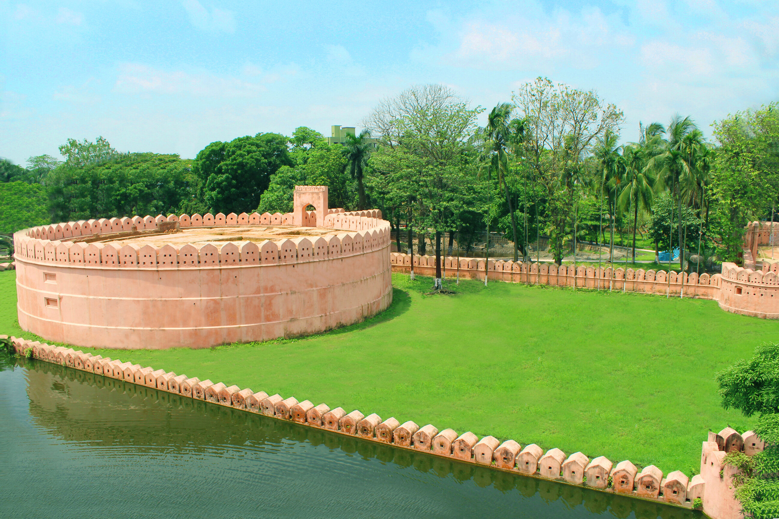
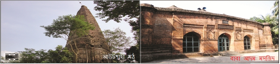
Today's Munshiganj district is part of Bikrampur, the glorious place of ancient Bengal. Munshiganj Idrakpur was a village at that time. It is said that there was a man named Munshi Haider Hossain in this Idrakpur village during the Mughal rule. He was appointed faujdar by the Mughal rulers. Munshiganj was named after Munshi Haider Hossain, a very gentle and philanthropist. In 1945, Munshiganj was upgraded to a police station and subdivision for the administrative convenience of British India. On 1 March 1984, it was transformed into Munshiganj district.
Shape of land:
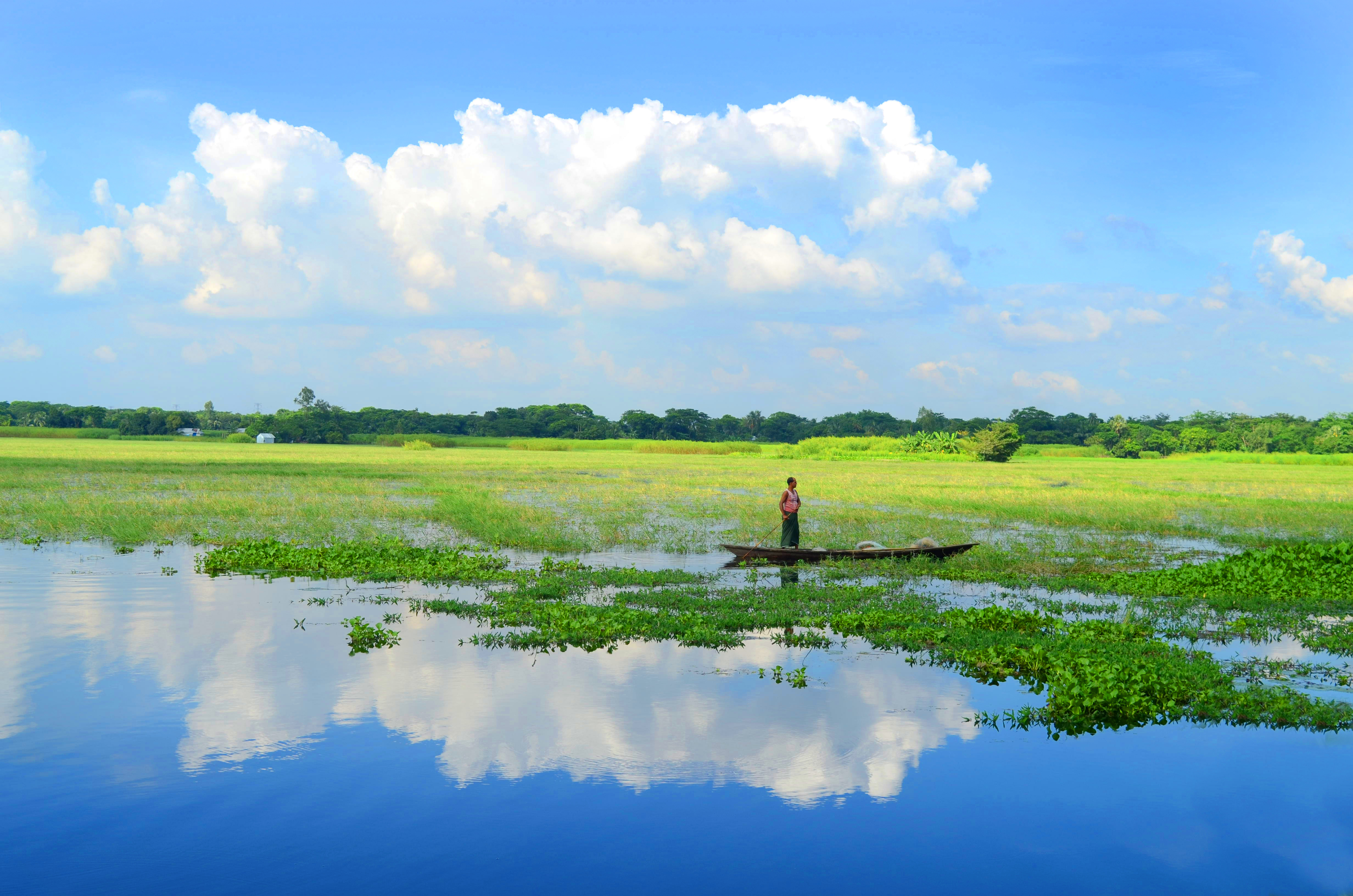
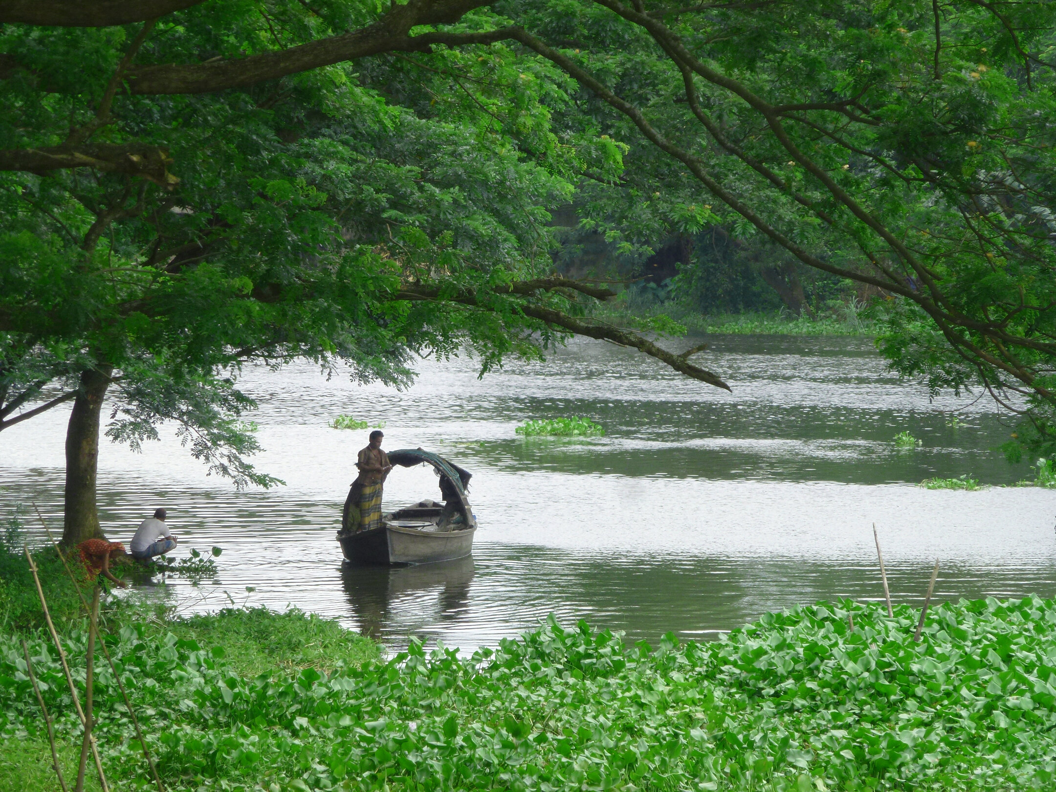
Munshiganj is not a flat area. Some areas of the district are high enough although there are no hills in the district. Most of the areas of Munshiganj are low lying areas and most of the areas are inundated with rains.
Location:
Munshiganj district is situated between 23.29 to 23.45 north latitude and 90.10 to 90.43 east longitude.
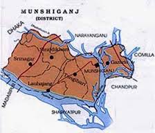
Geographical Boundaries:

East-Daudkandi and Homna upazilas of Comilla district, Matlab upazila of Chandpur district which is divided by Meghna river flowing with Munshiganj.

To the west, the Padma River divides Shariatpur and Madaripur districts.

North-Keraniganj and Dohar upazilas of Dhaka district and Bandar upazila of Narayanganj district.

South-Padma river on the other side of which Shariatpur district.
Climate:

The climate of Munshiganj is favorable. However, the number of humid and polluted areas is not less. The climate here is particularly changeable. The severity of winter in winter is not as severe as in other parts of the country. The area is temperate.

Size:

Total area is 235984 acres of which 136462 acres are cultivable and 5709 acres of low lying land.


Site was last updated:
2025-07-28 16:54:23
Planning and Implementation: Cabinet Division, A2I, BCC, DoICT and BASIS
Technical Assistance:
![]()
Developed By: